About the Study:

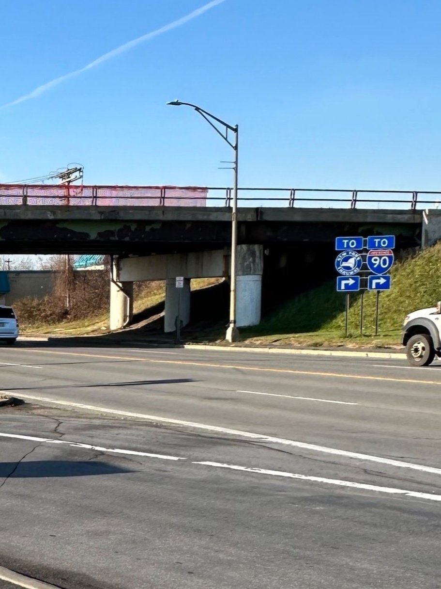
The I-90 Exit 31 is a major regional interchange, serving a unique blend of retail, commercial, light industrial, freight, entertainment, recreational, and residential uses. It is the gateway into North Utica, Downtown Utica, and the surrounding Mohawk Valley Region. However, the interchange poses challenges for safely and efficiently moving the traveling public.
To address these challenges, the Herkimer-Oneida Counties Transportation Council (HOCTC), in partnership with the New York State Department of Transportation (NYSDOT) Region 2 is undertaking a Planning and Environment Linkages (PEL) study centered on the transportation corridor at the New York State Thruway (I-90) Interchange 31 at N. Genesee Street (NYS Route 921 C).
The PEL study will also inform the environmental review for one or more future projects being progressed under the National Environmental Policy Act (NEPA).
Study Purpose, Objective, and Goals:
Transportation improvements at Exit 31 are needed to address roadway system linkages, mobility and accessibility, resiliency, and safety.
Study Purpose:
Roadway System Linkages
There are no direct connections between I-90, I-790, NYS Routes 5, 8, and 12, and 921C in both directions. Currently, all traffic exiting the Thruway (I-90) at Interchange 31 and destined to I-790, NYS Routes 5, 8, and 12 must use NYS Route 921C (North Genesee Street) and Auert Avenue to complete the missing connection, increasing the amount of regional traffic on State and local roadways. Similarly, traffic exiting I- 790 and entering the Thruway (I-90) at Interchange 31 must use several ramps that are poorly signed to complete the connection. This Study will identify proposed improvements to enhance roadway system linkages and wayfinding in the Study Area.
Mobility and Accessibility
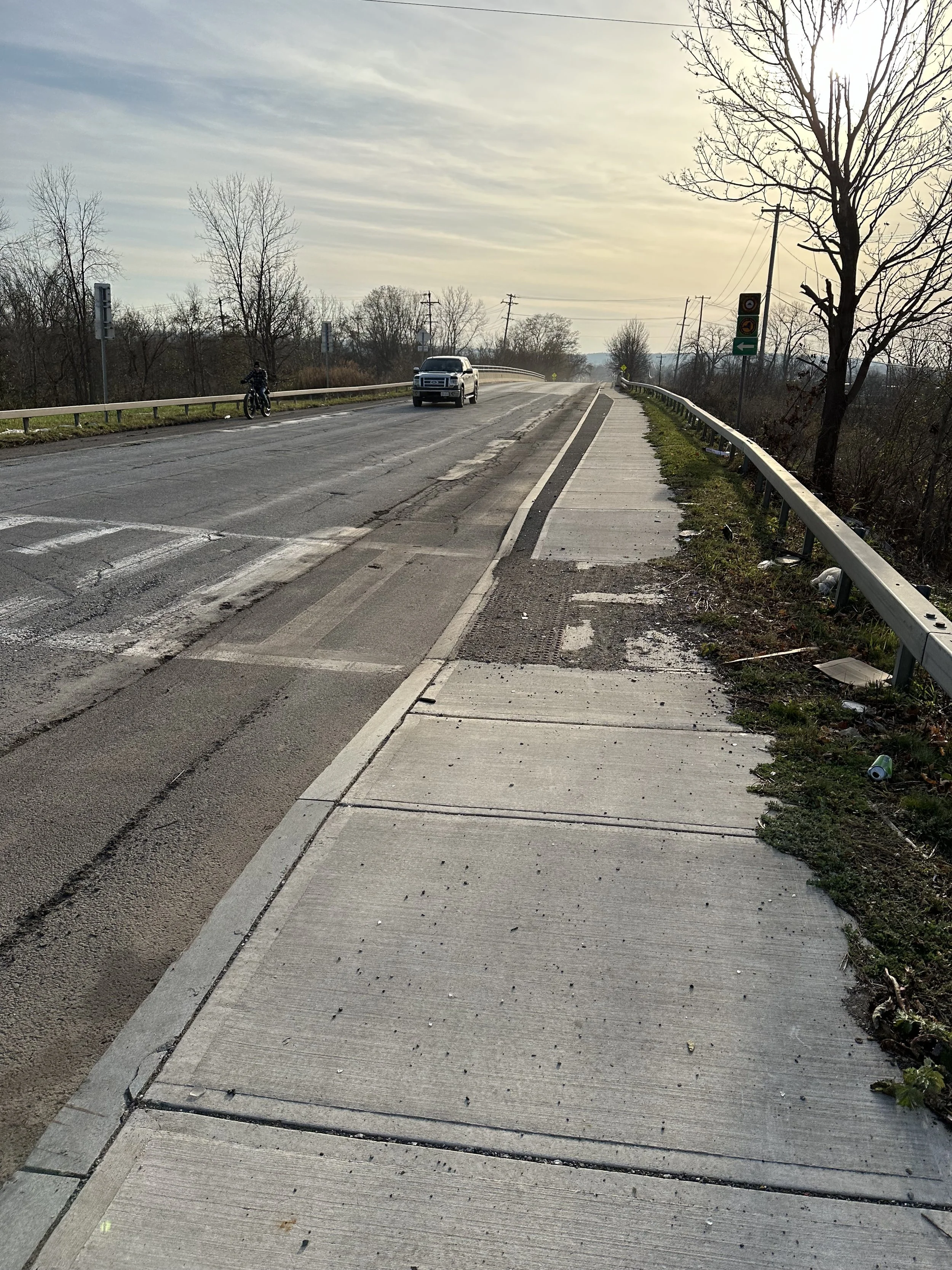
Current pedestrian, bicycle, and transit accommodations limit mobility between North Utica and Downtown Utica and limit connectivity to recreational assets such as the Erie Canalway Trail / Empire State Trail. Vehicles, pedestrians, and cyclists use North Genesee Street, Leland Avenue, Auert Avenue, and Wurz Avenue to travel through the area as well as access the surrounding neighborhoods. Sidewalks, crosswalks, and transit stops in the PEL Study Area are generally not compliant with the Public Right-of-Way Accessibility Guidelines (PROWAG). Pedestrian traffic currently travels along paved shoulder areas along portions of Leland Avenue. In addition, there are no crosswalks to allow pedestrians to cross North Genesee Street between Auert Avenue and Wurz Avenue (approximately 0.7 miles in length), and there are no dedicated or shared on-street bicycle lanes along North Genesee Street, Leland Avenue, Wurz Avenue, or Auert Avenue. This Study will identify proposed improvements to create a transportation network that improves accessibility and mobility for all roadway users, including passenger vehicles, freight, pedestrians (including pedestrians with disabilities and micromobility users), transit users, and cyclists, on North Genesee Street (921C), Auert Avenue, Herkimer Road, Trenton Road, Coventry Avenue, Wurz Avenue, and Leland Avenue.
Goals:
Resiliency:
Design should be developed for resiliency regarding long-term operations and maintenance of the interchange and local roadways.
Enhance the transportation system as to not preclude future development or contradict recommendations of the latest HOCTC Long Range Transportation Plan (LRTP), and help sustain existing businesses, support retail and employment opportunities, and create a vibrant economy, particularly for small businesses and entrepreneurs.
Create configurations that reduce the effect of flooding on roadway users of I-90, I-790, and Exit 31 and the associated ramps, as well as to not inhibit opportunities for additional floodwater storage through natural and manmade infrastructure.
Roadway System Connections:
Improve freight reliability on Interstate 90 through the Exit 31 interchange.
Maintain acceptable levels of service for a design period of 20 years in the PEL Study Area.
Safety:
Enhance safety for all roadway users by addressing intersections where expected crashes exceed crash (Safety Performance Function) predictions.
Note: These study goals will be refined based on input from the Technical Advisory Group (TAG) and public.
Technical Advisory Group:
The Technical Advisory Group (TAG) is comprised of state, regional, and local transportation experts who will meet on a regular basis to provide guidance on the Study and public engagement. Members of the TAG are represented by:
Herkimer-Oneida Counties Transportation Council (HOCTC)
New York State Department of Transportation (NYSDOT) Region 2
New York State Thruway Authority
City of Utica
Federal Highway Administration (FHWA), NY Division
Oneida County
Proposed Study Schedule:
Check back here often for more details as they become available!
>> Timeframe >> Public Input Opportunities >> Study Deliverable Schedule
Fall 2023 Data Collection & Existing Conditions Analysis
Winter 2023 Data Collection & Existing Conditions Analysis
Spring 2024 Data Collection & Existing Conditions Analysis
Summer 2024 Public Workshop #1 Data Collection & Existing Conditions Analysis
Winter 2024 Public Workshop #2 Conceptual Design Alternatives Developed
Spring 2025 Conceptual Design Alternatives Developed
Summer 2025 Conceptual Design Alternatives Developed
Fall 2025 Public Workshop #3 Screening Criteria for Concept Alternatives
Spring 2026 Public Workshop #4 Preferred Conceptual Alternative and Final Study Report
PEL Study Area Boundary Expansion

Purpose of Expanded Study Area: After careful consideration of feedback received at Public Meeting #1 and Public Meeting #2 and collaboration with stakeholders including the New York State Department of Transportation (NYSDOT) and New York State Thruway Authority (NYSTA), the project team proposed an expanded PEL Study Area which is described in greater detail below. The updated Study Area includes key intersections to the north, the entirety of the Exit 31 interchange to the east and an expanded area to the west to include potential roadway reconfiguration including potential on/off ramps proposed in some of the concept alternatives.
Changes to the North: Includes Coventry Avenue and Trenton Road north to Servis Place.
Changes to the East: Includes publicly owned parcels along I90 and includes the entire “trumpet” interchange of the existing Exit 31.
Changes to the West: Expanded to include I90 right of way to the NY-49 “split” (NYSDOT-owned “Airport” parcel) to account for potential on/off ramps proposed in some concept alternatives.
More about PEL
“Planning and Environment Linkages (PEL) is a valuable tool for creating efficiencies in the transportation project development process that supports agencies' efforts to accelerate project delivery. PEL represents a collaborative and integrated approach to transportation decision-making that considers benefits and impacts of proposed transportation system improvements to the environment, community, and economy during the transportation planning process to inform the environmental review process.”

Source: US Department of Transportation Federal Highway Administration Planning and Environment Linkages Handbook